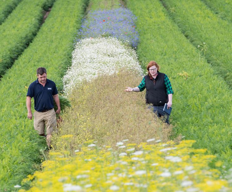
The big picture: using wildflower strips for pest control
They may be beautiful, but these strips prove pretty deadly for every farmer's mortal enemy: aphids
There are widespread concerns about the externalities arising from intensive farming, including water quality impacts and GHG emissions. These can have detrimental impacts beyond agricultural fields. Robust evidence at landscape scale is needed to support the development of mitigation and adaptation strategies to achieve sustainable development in our challenging and ever changing environment.
With advances in environmental sensor technologies, including in-situ, real time and multiple pollutant sensors the monitoring of river systems has increasingly become an integral part of adaptive management and evaluation in order to assess and improve the provision of various ecosystem services at landscape scale.
Given ongoing policy objectives concerning the need to improve the sustainability of current farm practices, a strategic research programme, Soil-to-Nutrition, funded by UKRI-BBSRC, is focussing on exploring and optimising pathways for sustainable agriculture at policy relevant scales. Accordingly, a multi-scale observatory - the Upper River Taw Observatory (URTO) - has been established in a landscape with mixed land use to support the integration of science, stakeholder engagement and policy support. The observatory serves as an open landscape laboratory, showcasing active research relevant to multiple stakeholders and sectors, and provides a platform for fostering national and international collaborations. River water quality monitoring in the URTO has been operational since October 2018.
The URTO exists within the Upper River Taw catchment with its outlets at 50.779893 N -3.905089 W (DD in OSGB). It is estimated to be 19 km in length up to the source of the river on Dartmoor, yielding an area of 41.4 km2. The soils of the lowland portions of the study catchment are typically poorly draining clay rich gleys and typical brown earths, while the soils on the Dartmoor upland at the source consist of peat and podzols. River hydrology is surface water driven, reflecting the low permeability of the soils, sub-soils, and lithology and, as a result, river discharge responds rapidly to rainfall.
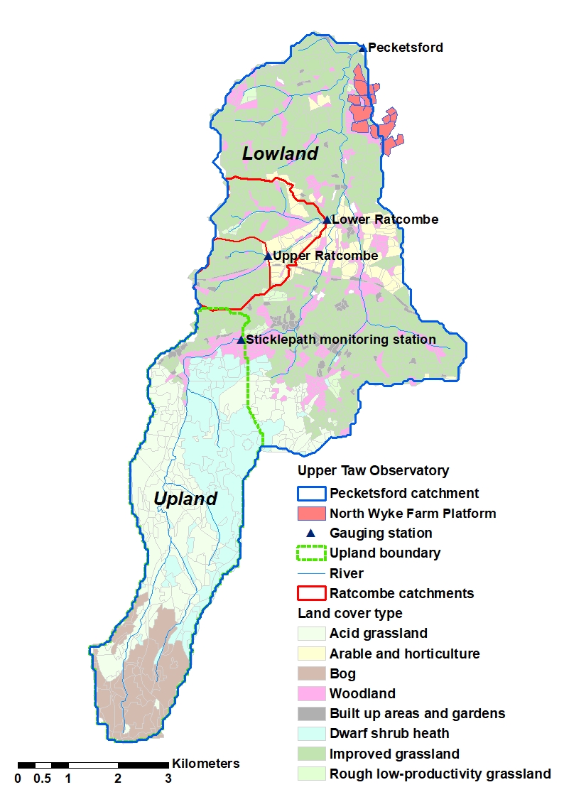
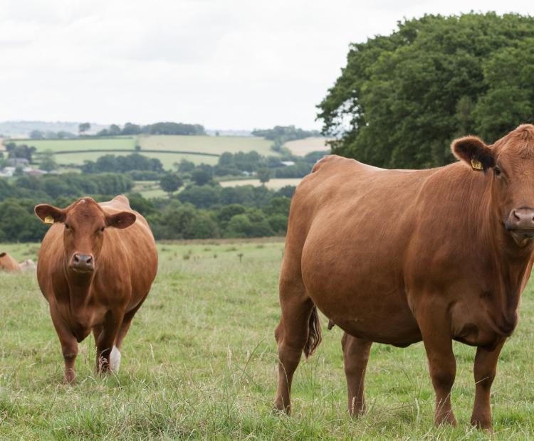
Despite the low groundwater storage capacity of the underlying geology, water stored within the peat soils on Dartmoor and rock fissures of the Carboniferous country rock, does continue to feed river discharge and maintain base flow during extended dry periods. Land use within the catchment is dominated by the unimproved moorlands of Dartmoor (38%), and improved agricultural grasslands (44%) supporting beef, dairy and sheep production, with a limited amount of cultivated land (7%) and woodland (10%).
Within the Upper River Taw catchment, two smaller nested sub-catchments are monitored; these are referred to as Lower Ratcombe and Upper Ratcombe, respectively, and both catchments occur on the poorly draining clay rich gley soils and brown earths of the Upper Taw catchment. Upper Ratcombe is the smallest catchment (1.7km2) and is dominated by permanent grassland (87%), with woodland (7%) and built-up areas (4%) being the next most important land uses. The Lower Ratcombe catchment drains an area of (4.4km2). Permanent grassland (71%) and woodland (10%) still make up significant proportions of the land use; however, within Lower Ratcombe, arable land comprises 18% of the land area.
Rainfall monitoring: Rainfall is recorded using a tipping bucket rain gauge every 15 minutes at the upper and lower ends of the catchment by the Environment Agency. Their respective national grid references are SX604911 (station ID: 50105) and SX647948 (station ID: 50106). Updated rainfall data at these two stations are available with the specification of their station IDs. More detailed rainfall data are also available from North Wyke Farm Platform data portal.
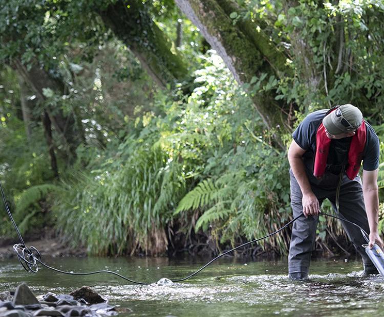
Flow monitoring: River flow is measured using streambed mounted sensors within a surveyed section of the channel. Water velocity is measured using an ultrasound sensor while water level is measured using a pressure level sensor. Combining these sources of information with the channel cross sectional area calculates the river discharge
Continuous water quality monitoring: At all catchment river monitoring sites, a multi-parameter sonde housed within a still well measures seven water quality parameters: temperature, specific conductivity, turbidity, nitrate-N (NO3-), ammonium-N (NH4+) and pH. The values of pH and NH4+ allow for the calculation of ammonia (NH3). Instrument measurements are controlled, and data recalled via a telemetry system every 15 minutes.
At the main catchment outlet of the URTO, total phosphorus (TP) is measured automatically using a Phosphax auto-analyser. Instream automated measurements are also supplemented by the collection of less frequent physical samples using ISCO auto-samplers for targeted storm events. These samples are subsequently analysed within the North Wyke analytical laboratory.
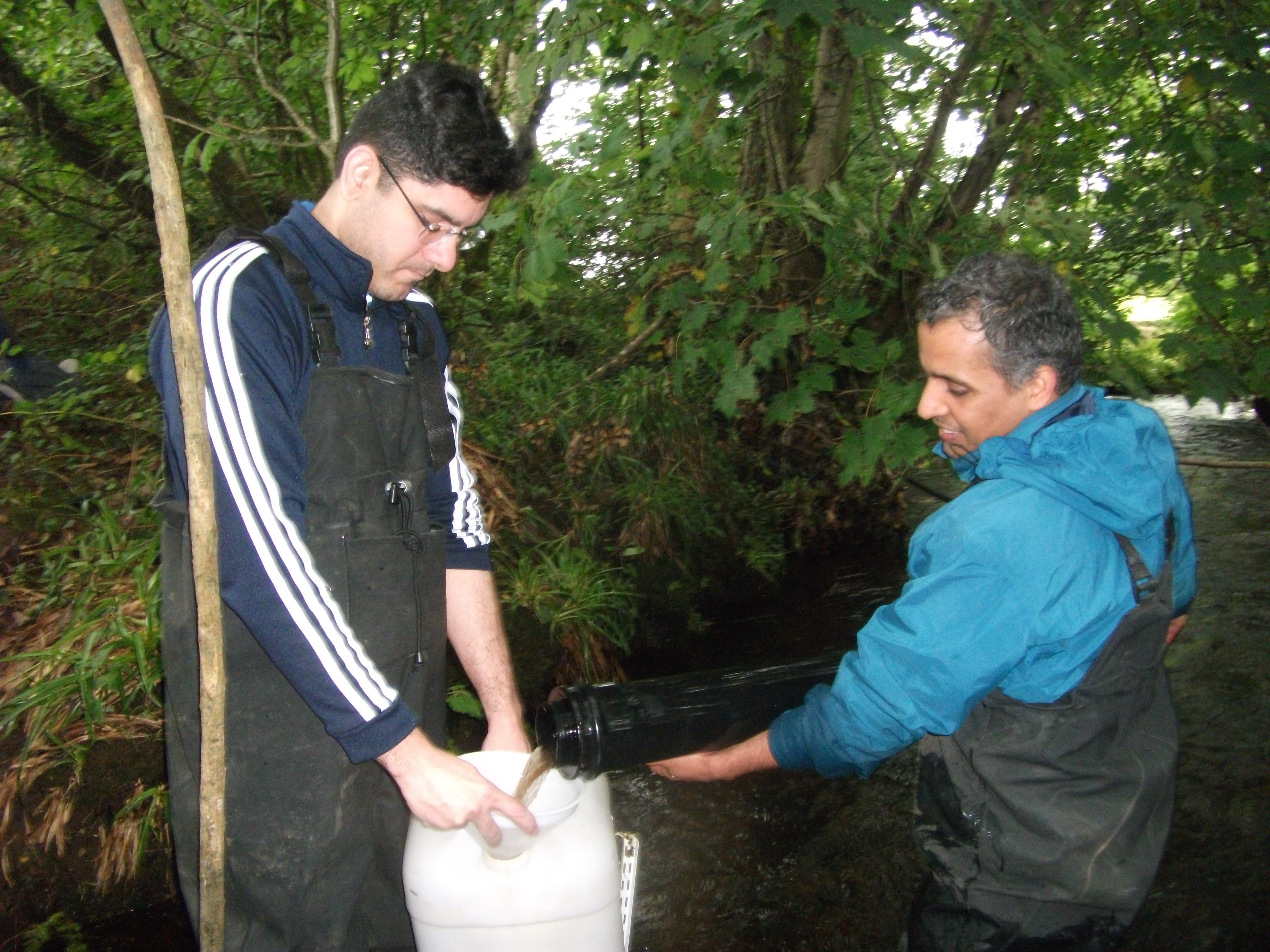
Storm sampling: Samples are collected from the catchment outlets using ISCO auto-samplers for targeted storm events.
External monitoring: There is a long-term gauging station maintained by the national measuring authority in UK, the Environment Agency, in the upper River Taw observatory, namely the ‘Taw at Sticklepath’ (50003). Daily rainfall and quality assured flow data since 1975 are available for research use. More detailed information about the station can be found online. Water samples were also collected and analysed on a monthly basis between 1990 and 2004 as part of statutory monitoring schemes for the implementation of relevant EU directives, such as the Nitrate Directive and Water Framework Directive. Recent monitoring data has become available for public access via a water quality data archive.

Science Director

Environmental Scientist

Research Scientist

Science Technician

Hydrologist

Scientific Technician - Hydrology
Professor Mike Stone at the Department of Geography and Environmental Management, University of Waterloo
UK Environment Agency